Wayland's Smithy Walk
Our stunning Wayland's Smithy walk visits five ancient monuments and climbs to the highest point in Oxfordshire for outstanding views over six counties. This wonderful walk is full of myths and legends, dragon slaying, spies, a chalk horse, an iron age fort, a long barrow burial chamber, and so much mystical atmosphere. All this is packed within the short distance of 4.7 miles, which could be easily extended when wishing for a longer walk, as there are lots of footpaths to choose from.
And don’t let the mention of climbing to the highest point in Oxfordshire put you off, as its only 262 metres (860 feet) tall and most of the climbing is done in the car to get to the car park!
The start point of our Wayland’s Smithy Walk is the White Horse Hill Car Park near Uffington in Oxfordshire. This in a National Trust car park and there is a small fee to pay for non-members. SAT NAV users should use the postcode SN7 7UK to help guide them to the area and follow the brown signs for Uffington White Horse and Wayland’s Smithy parking. Care is required on the approach to the car park as the road is narrow and steep.
If you follow our walking route, then we visited these sights in the order given below.
1) The Uffington White Horse
2) Dragon Hill
3) Uffington Castle
4) The Ridgeway
5) Wayland’s Smithy
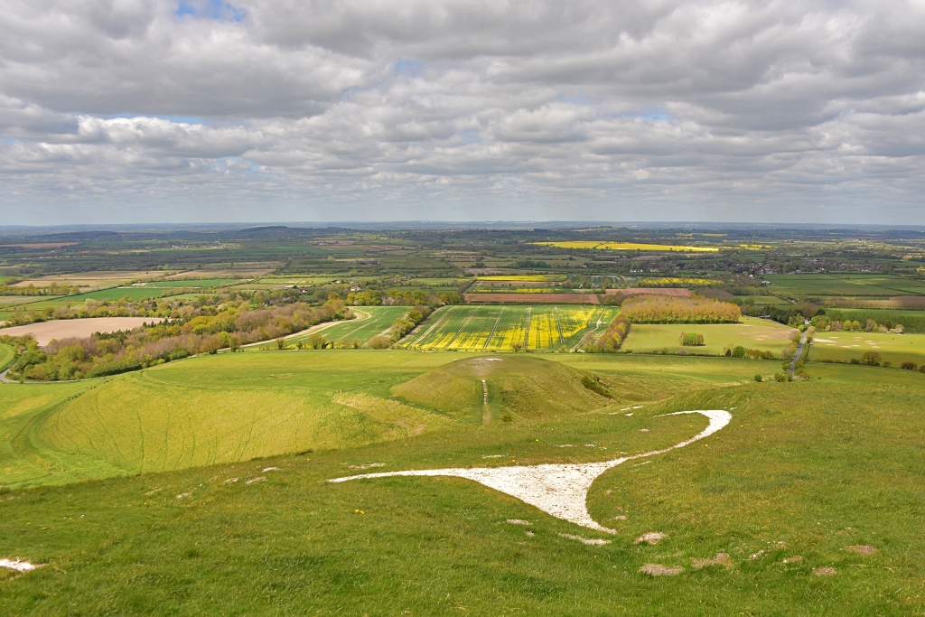 View from Uffington White Horse to Dragon Hill © essentially-england.com
Wayland's Smithy Walk Map
To enlarge our Wayland’s Smithy walking map, download the gpx file, or use on your mobile device via the komoot.com app click on the “Discover more info about this tour” link. Much of the walk is signposted, but it’s always good to have a map of some sort to follow.
Wayland's Smithy Walk Map
We left the car park through one of the gates that led into a large grassy meadow and followed the worn path signposted to the White Horse. Passing through a gate, we carefully crossed the road and continued to gently climb following direction signs to the White Horse.
The Uffington White Horse
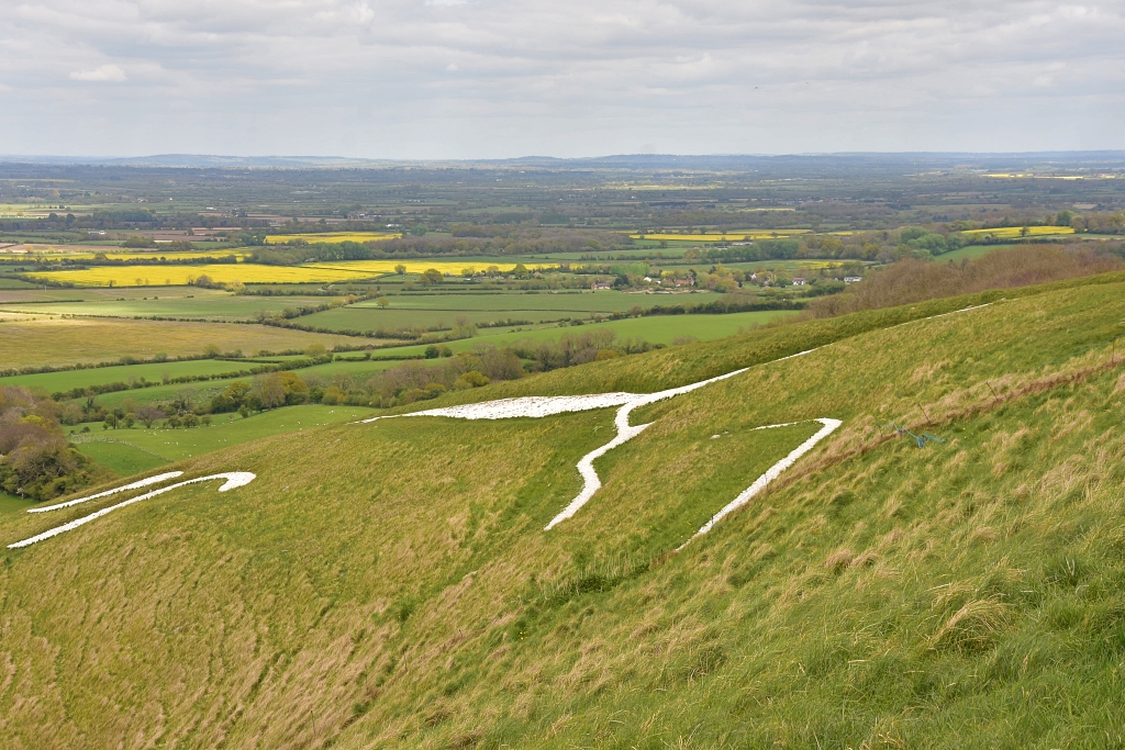 The Uffington White Horse © essentially-england.com
The Uffington White Horse is the oldest dated chalk figure in England and is around 3000 years old. It was made by cutting trenches in the hillside and filling them with white chalk blocks. The best views are from a distance, or from above. Up close it’s very hard to make out the shape due to the slope of the hill. Rumour has it that one night a year the horse goes down to graze at the Manger just to the west of Dragon Hill. Also, if it needs a new set of horseshoes it goes to Wayland’s Smithy!
We continued on the signposted footpath that leads around the top of the white horse to descend a chalky path back towards the road. After crossing the road, we climbed the steps to the top of Dragon Hill.
Dragon Hill
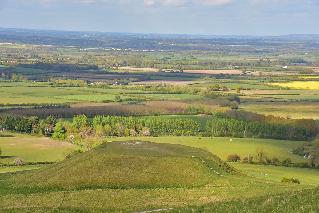 Dragon Hill © essentially-england.com
Dragon Hill is about 10 metres, or 30 feet in English money, high and was formed during the last Ice Age. The site was quarried, and the top levelled off by the Celtic Dobunni tribe prior to the Roman invasion.
However, the hill takes its name from the legend that tells us this is where St George, the Patron Saint of England, killed a dragon. As the dragon lay dying on the hilltop its poisonous blood contaminated the ground so that nothing would ever grow there again, hence the white spot.
It's a great legend, but probably not true as St George wasn’t English and there’s no historical evidence that he visited this area. Other suggestions for the white mark include it being a burial site or a pagan ceremony site.
Also, this was the site where atomic physicist Klaus Fuchs handed over top secret documents to the Russian secret service in the 1950’s. Dragons, spies, burials, and pagan ceremonies aside, it made a lovely picnic spot for us!
From the top of Dragon Hill you'll get great views of the unusually shaped hillside that drops into the valley. It’s called the Manger and, like Dragon Hill, was also formed during the last Ice Age. This is the peaceful night-time grazing area for the Uffington White Horse.
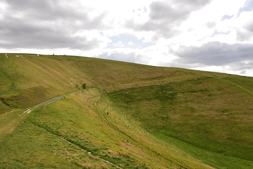 View of the Manger from Dragon Hill
 © essentially-england.com
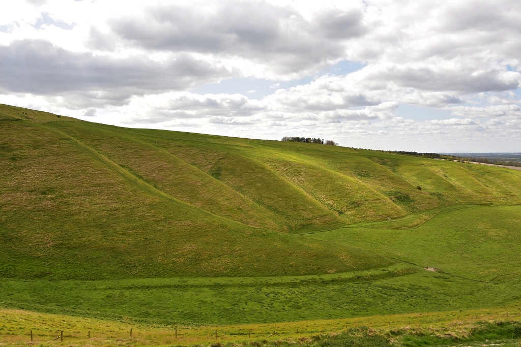 View of the Manger from Dragon Hill
 © essentially-england.com
From Dragon Hill, we retraced our footsteps back up to the White Horse and climbed to Uffington Castle, the highest point in Oxfordshire. There is a Trig Point just outside the banks and ditches.
Uffington Castle
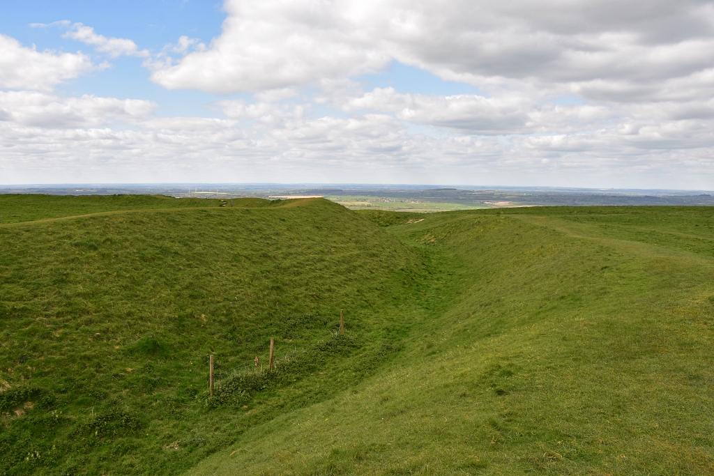 The Ramparts of Uffington Castle
On the exposed summit of White Horse Hill is the Iron Age hill fort known as Uffington Castle. Its large enclosure is surrounded by clear bank and ditch ramparts which are several metres in height or depth. On top of the ramparts would have been a wooden palisade made from tree trunks that were felled in the valley. Within the enclosure post holes and pits have been found suggesting there were several large round houses.
It must have been harsh living up here, as we could really feel the chill of the wind. With it being so exposed, we noted several families flying kites and a number of remote-controlled model gliders.
Since we do not have a drone to take aerial photos, I have created a google map image of White Horse Hill so that the Uffington White Horse and Uffington Castle can be seen in a better perspective. Just zoom in and out and move around and you should get a clearer idea of the landscape.
We walked around the eastern and southern side of Uffington Castle to follow a path down to a large wooden gate and into the next field. The footpath across the field took us to a metal kissing gate and onto the ancient Ridgeway track, where we turned to the right.
The Ridgeway
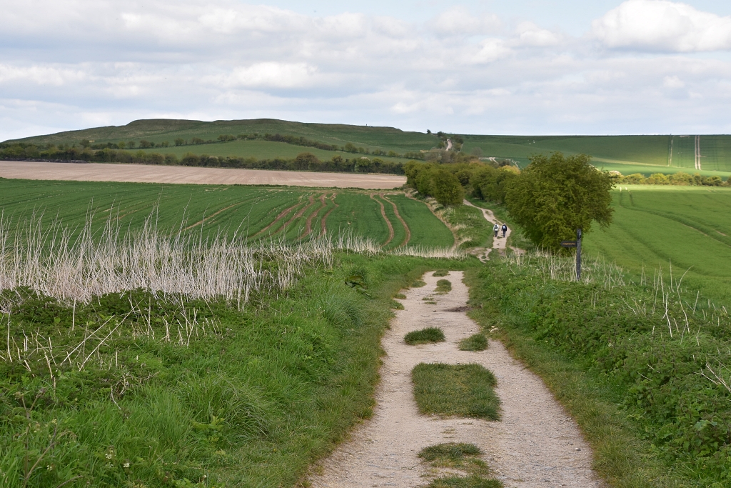 The Ridgeway Heading Towards Uffington Castle
 © essentially-england.com
The Ridgeway National Trail is an 87-mile route that starts near Avebury in Wiltshire and ends on Ivinghoe Beacon in Buckinghamshire. This is Britain’s oldest road and was first walked by prehistoric man.
The original route was far longer and travelled between the Dorset and Norfolk coasts over some 250 miles. The trail was favoured as it stayed on higher, drier ground and was less forested.
Today, it makes an excellent place for walking, cycling, and horse riding.
We ignored all turn-offs and crossroads and kept to the Ridgeway until we came to the path on the right that took us through a plantation of trees into Wayland’s Smithy.
Wayland's Smithy
There’s certainly an atmosphere around Wayland’s Smithy. This 5000-year-old Neolithic long barrow gets its name from Wayland, the Saxon god of metal working. Myth has it that if you tether your horse here and leave some coins Wayland will re-shoe your horse whilst you are away!
The burial chamber
was used in two phases. The first structure was of stone and wood laid over
a sarsen stone floor. On the floor was a wooden box containing the remains of 14
people. Samples from the box were dated to between 3590 and 3550 BC.
After a period of around 150 years, the burial chamber was extended and re-used. This was a much larger structure and had a stone chamber with a grand façade of larger standing stones. Both chambers were then encased in chalk and soil from two ditches dug either side of the long barrow. The remains of 8 people have been found in the second chamber.
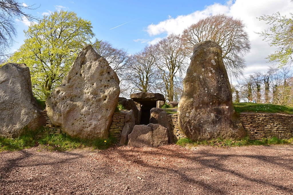 Wayland's Smithy Burial Chamber © essentially-england.com
To complete our Wayland's Smithy walk we re-joined the Ridgeway and retraced our steps towards Uffington Castle, taking the same small footpath and passing through the same gates back to the ramparts. We followed the edge of the ramparts to complete a circuit around the fort and returned to the car park.
What a thoroughly nice walk, with great views and atmosphere. We hope you enjoy it too…
For more information on White Horse Hill and Wayland's Smithy visit the National Trust and English Heritage websites.
Oxfordshire Holiday Cottages
The Oxfordshire landscape consists of gently rolling farmland which grows hillier towards the Chilterns. It boasts a maze of small roads and footpaths, making it an excellent destination for walking and cycling holidays, and ideal for short breaks.
For the less energetic, Oxfordshire brims with history and wonderful places to visit: the university city of Oxford and its grand buildings oozing history, the picturesque town of Woodstock and grand Blenheim Palace, small Cotswold towns and smaller villages, and - of course - the River Thames.
If you're a Downton Abbey fan, then you might like to know that many of the scenes were filmed in Oxfordshire. The charming town of Bampton was used as the Downton Abbey village.
Why not visit and spend a few days wandering between spires, Roman mosaics, ancient standing stones, and green, rolling hills? Here are a few ideas of where you could stay:
To browse holiday cottages in other parts of England click here.
If you need to find a hotel, then try one of these search platforms...
If you need to find a hotel, then try one of these search platforms...
Click here to return from our Wayland's Smithy walk page to our things to do in England page.


